Thursday, May 29, 2014

Montclair Sales Office and Observatory


Crowd of prospective buyers arrive at the Real Estate sales office and observatory in Montclair Hills - 1923 (per license plate), possibly driving Chevrolet's made nearby in the automakers factory in East Oakland.  Oakland made some many vehicles in the day that it was dubbed the "Detroit of the West", which was actually consider to be a good moniker.

Sign on the building at the bluff proclaims, "Oakland, the Greatest City on the Pacific Coast - INVEST!" - indeed this is an overlook with sweeping panoramic views of Oakland, San Francisco and the Golden Gate.

Where is this?

We verified the typography around Asilomar/Aztec and Balboa and think that the mystery is solved on where this was located. We believe the current Mediterranean house, (built 1935), is just North of the where the original observatory tower was located, and Aztec, just graded on the right in the photo, is the street that heads down the hill.  The owner of this house has coincidentally restored a 1929 Ford Model A that sits in his driveway. The hillside in the distant left, and the drop off on both sides of the intersection match the bluff in the view. However, no one we met had any knowledge of this and there is no way to photograph this to create a "then now" view,


In 1928 a house was built for Paul Pause of Montclair Reality 229 Monterrey Drive, which was changed to Asilomar Drive.  I think the address is 2054 or 2059

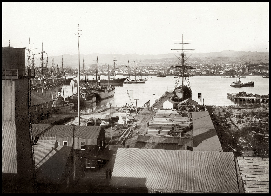
This is definitely not related to Chabot in any way.


picture available here
 
Background: Montclair, Oakland California History
_________________________________________________________

from Wikipedia:
Prior to the Spanish Mission era, native Huchiun and Jalquin tribes of Ohlone Indians populated the general area. The Ohlone by tradition gathered nuts, seeds, roots and fruit, hunted small animals and fished local waterways and the bay.  Later, the Mission system centered around Mission San Jose introduced Christianity, a lifestyle in farming, cattle raising, and unfortunately disease and other problems that led to the native inhabitants being largely eliminated.

In the early 1800's - the hills here had great Redwood forests - among the tallest on Earth - up to 31' in diameter.  The Redwoods were in fact so high they were depicted on the navigation maps of the time to aide ships entering the San Francisco Bay find their bearings. By around 1860 the first growth was gone, many brought down what is not Park Ave to the wharves in the vicinity of 14th, and use to build San Francisco - many via the first steam saw mill owned by a pioneer named Thorn - hence the name "Thornhill"

In 1820, Montclair and Dimond Canyon were part of the land from El Cerrito to San Leandro, which was granted to Luis Maria Peralta. In 1842, Peralta divided his land among his sons and the San Antonio section including Montclair and Dimond Canyon went to his son Antonio Maria Peralta.

Prior to modern development, Montclair was geographically demarcated by two creek valleys, one on the northwest, and one on the southeast end of the Hayward Fault rift. The upper reaches of Temescal Creek ran through the northwest valley, and remains visible above ground today in the upper sections along Thornhill and Pinehaven Roads. The creek has two branches that join at the intersection of Thornhill and Pinehaven. From there, the creek flows down then south side Thornhill Dr. until Thornhill Elementary School were it then undergrounds. Then it flows underground down the remainder of Thornhilll and then down Mountain Blvd. to Broadway Terrace, before draining into Lake Temescal.

In the northern creek valley, Thornhill Road dates back to some of the earliest development history of Montclair. This was an old 19th century logging road built by and named after Hiram Thorn. Thorn's road brought redwood logs to Oakland out of the vast forest known as the Moraga Redwoods, where he ran a lumber mill at Pinehurst Road near Huckleberry Botanic Regional Preserve, west of the community of Canyon. Thornhill later became a toll road to Contra Costa County.

On the southeast end of Montclair, the north fork of Sausal Creek (also called Shepherd Creek) runs down Shepherd Canyon. At the freeway, near the parking lot of the Montclair Golf Course, the north fork of Sausal Creek has its confluence with the south fork (also called Palo Seco Creek) running from the eastern hills (encompassing Joaquin Miller Park). The creek then runs down through Dimond Canyon and across the flatlands (mostly in culverts) to San Francisco Bay.

From Shepherd Canyon extending toward the southeast, the Bayside hills were covered in a vast redwood forest known as the San Antonio Redwoods. Around 1847, Europeans started logging the San Antonio redwood forest. In 1850, the area's first steam sawmill was built on the edge of Montclair, at Palo Seco Creek in the head of Dimond Canyon [1]. A logging road to the mill was built high up along the side of Dimond Canyon, and later became Park Boulevard. This logging road connected to a wharf at the foot of 13th Avenue and was used to transport the logs down Dimond Canyon to the Bay. By 1860, the San Antonio forest was logged completely.

After the logging period, Caspar Hopkins, an early settler of the Fruitvale District, formed the Sausal Creek Water Company and built a dam and reservoir at the upper end of Dimond Canyon near the current Highway 13 at Montclair. The reservoir later became part of the East Bay Water Company and remained until the early 1920s. Early maps show a road passing the reservoir along the current Waterhouse Road, and extending up toward the dam in the direction of Bridgeview Drive along what is currently the Upper Dimond Canyon Trail. In 1867, Hugh Dimond purchased the canyon. [2]
In the first half of the 20th century, the main line of the Sacramento Northern Railroad ran through Montclair. The tracks ran southward from Lake Temescal and crossed into Montclair over a trestle at Moraga Ave. and Thornhill Dr. Thre is now a "pocket park" located at this location in remembrance of this crossing. Then the route ran along a high berm between Montclair Recreation Center and Montclair Elementary School, before crossing Mountain Blvd. and Snake Road via trestle, and continuing up Shepherd Canyon to a tunnel, the west portal of which was located immediately below Saroni Drive. Today, much of the old right-of-way above the village and in Shepherd Canyon is a pedestrian and bicycle path. Although the old railroad trestles throughout Montclair were all removed decades ago, in recent years a pedestrian bridge was built in the same location of one of them, across Snake Road, to connect the two major sections of the pedestrian pathway. The trail was paved as well at the same time.


Viewing towards Skyline and the new road leading to the Observation Tower -
On the left is perhaps the "First Real Estate Sign" in Montclair
________________________________________________________


One of the first schools located in Montclair was at the current site of the now-closed Moraga Avenue firehouse, and was named in honor of John Coffee Hays, one of the founders of the city of Oakland. The Hays school was closed in 1913. Though already sparsely populated since the logging days, major residential subdivision of the village and hills began in the 1920s.

The 1927 [3] Montclair firehouse was designed in the Hansel and Gretel style [4] by famed regional architect Julia Morgan, and attributed to her but who actually designed this structure is uncertain at this timed.

Following the 1989 Loma Prieta earthquake, the Oakland Fire Department built a new station house on Shepherd Canyon Road, and upon completion, vacated the 1927 structure.   According to comments here: "Neither the firehouse nor the library was designed by Julia Morgan. The firehouse was by Eldred E. Edwards of the Oakland Public Works Department. See Wiki on Montclair Firehouse

In March 1930, the Montclair branch of the Oakland Public Library was opened on Mountain Blvd. near Thornhill Dr. to serve the growing village. The small building was built in the English cottage-style, and remains in use today. After 1965, additions were completed for the children's room and patio at the rear of the original building. [5]


Montclair viewing Southeast, c1925
________________________________________________________

The sign on the Real Estate Office ('shack') is inscribed 6501 Moraga - This may be where the Highway 13 was latter built - we are trying to determine the GPS coordinates for confirm

_________________________________________________________________________
Pictures digitally mastered by Bennett Hall, Business Image Group from
source images in the History Room of the Oakland Public Library (please join them!)

To order prints of Oakland History:
Oakland Historical Photographs for your home of office 

Flickr Collection on Alameda-Coco Country History

LINKS RELATED TO MONTCLAIR and East Bay Hills
_________________________________________________________________________
East Bay Hills Project : Great resource of photography and information on East Bay Hills

Montclair Village Association

Wikipedia: http://en.wikipedia.org/wiki/Montclair,_Oakland,_California


Tuesday, May 27, 2014

Oakland formation in 1854...

The Early days of the City of Oakland

__________________________________________________________


Booming Waterfront and Rail development, but oh the Controversies! 

________________________________________________________________________________


The California State legislature incorporated the town of Oakland on May 4, 1852.  

Who is the Mayor?  Actually, from incorporation until 1900, Oakland managed to go through
30 mayors, thus changing of the political powers that be was in effect the nature of the growing communities civic engagement.

Incorporated in 1854, Horace W. Carpentier became Oakland's first elected mayor in an election where his 364 votes cast out-numbered the official voting population of the town.  Thirteen days later, Mayor Carpentier, obtained the exclusive use of the Waterfront, a matter that lingered for a period of thirty years, and resulting in a never ended contentious wrangling for control over the evolving and increasingly valuable real estate, rail and shipping interests.


In 1855, in reaction and outrage to Carpentier's land grab, he was expelled from the office of mayor. A lengthy court battle then ensued over ownership of the Waterfront. Suffice to say that all the power players were engaged, fighting with everything they had, railroads in particular leading the charge over access to what now obviously prime real estate as the Transcontinental railroads were envisioned to forge across America.

__________________________________________________________


The Long Wharf and a Mole Evolve for passenger and freight transport

__________________________________________________________________

This massive railroad wharf and ferry pier, located at the foot of Seventh Street, was acquired and extended by the Central Pacific Railroad in 1868 to transport freight to San Francisco. It served as the western terminus of the first Transcontinental railroad when it was completed in 1869. The Long Wharf connected to ferries that carried commuters and cargo to and from San Francisco.  Part of the wharf was filled in between 1879 and 1882, creating a mole. It remained in service until 1958.

In 1868, the possibility that Oakland might be selected as the western terminus for the transcontinental railroad brings the dispute with Carpentier to a head. Carpentier agreed to deed his rights to the Oakland Waterfront Company, however,  later it was discovered that Carpentier was in fact the President of the Oakland Waterfront Company.  The Central Pacific constructed the Oakland Long Wharf at Oakland Point, the site of today's Port of Oakland. The Long Wharf served as both the terminus of the Transcontinental Railroad as well as the local commuter trains of the Central (later, Southern) Pacific. The Central Pacific also established one of its largest rail yards and servicing facilities in West Oakland which continued to be a major local employer under the Southern Pacific well into the 20th century.

Wiki of the Mayor's of Oakland - dozens and dozens of them

__________________________________________________________________

Pictures digitally mastered by Bennett Hall, Business Image Group from
source images in the History Room of the Oakland Public Library

To order prints of Oakland History:
Oakland Historical Photographs for your home of office 

Celebrating Oakland's rich Waterfront Heritage


The vitality of our community's development owes a great debt of gratitude to the men and women who have dedicated their lives and careers here.  This series of images has been organized out of respect to their longstanding service. Our future in a multitude of ways depends on success of our Port and how it continues to evolve both in its traditional role for the movement of freight but the evolving public access and development that are presently on the drawing boards.


Ships Loading Lumber, Oakland Estuary, c.1870
_________________________________________________________________

The Oakland hills were covered with a vast redwood forest known as the San Antonio Redwood, which had some of the largest trees on earth. Between 1842 and 1853 this forest was logged extensively to supply San Francisco with lumber. The area’s first steam sawmill was built on the edge of Montclair in 1850. A logging road from the mill, later Park Blvd., connecting to the wharf at the foot of 13th Avenue, where ships transported lumber to San Francisco from this estuary. This forest was gone by 1860.


Long Wharf, Oakland
Yerba Buena Island in background c.1870
______________________________________________________

 This massive railroad wharf and ferry pier, located at the foot of Seventh Street, was acquired and extended by the Central Pacific Railroad in 1868 to transport freight to San Francisco. It served as the western terminus of the first Transcontinental railroad when it was completed in 1869. The Long Wharf connected to ferries that carried commuters and cargo to and from San Francisco.  Local commuter trains also used the pier, while trains of the Pacific Railroad (aka the "First Transcontinental Railroad") used another wharf in Alameda for briefly in 1869, after which the Oakland Long Wharf became the western terminus of the Pacific Railroad as well. Part of the wharf was filled in between 1879 and 1882, creating a mole. It remained in service until 1958.

–courtesy of Oakland History Room, Oakland Public Library


Long Wharf, Oakland  c. 1870

In 1868, the possibility that Oakland might be selected as the western terminus for the transcontinental railroad brings the dispute with Carpentier to a head. Carpentier agreed to deed his rights to the Oakland Waterfront Company, however,  later it was discovered that Carpentier was in fact the President of the Oakland Waterfront Company.  The Central Pacific constructed the Oakland Long Wharf at Oakland Point, the site of today's Port of Oakland. The Long Wharf served as both the terminus of the Transcontinental Railroad as well as the local commuter trains of the Central (later, Southern) Pacific. The Central Pacific also established one of its largest rail yards and servicing facilities in West Oakland which continued to be a major local employer under the Southern Pacific well into the 20th century.

Wiki of the Mayor's of Oakland - and... there are dozens and dozens of them even before 1900!


Brooklyn Basin, Oakland Harbor, 
Viewing North from Alameda, c.1890

____________________________________________________________

Booming commerce in the late 19th century led to the need for the expansion of shipping facilities in both Oakland and Alameda. A shipping and tidal channel was dredged between them in 1902, extending and deepening the natural estuary joining Oakland’s harbor with the San Leandro Bay. Consequently, Alameda became an “island” as well as an important shipping port. Most of the excavated soil was used to fill sections of the nearby marsh land.

Brooklyn Basin is now the site of largest development on the Oakland/East Bay Waterfront, with billions of dollars being invested in this area become a major neighborhood and commercial center.

Contra Costa Times News Story on the Ground breaking


“San Francisco” Ferry at Oakland Mole
Key Route Pier, c.1920
_______________________________________

The Mole was a dock halfway out Oakland’s Long Wharf used by Southern Pacific ferries
to connect with the Key System. The Key System, formed in 1903, was a network of commuter rail and bus lines connecting cities and neighborhoods in the East Bay to
San Francisco by way of the Mole. After completion of the Bay Bridge, use of the Mole declined but continued until about 1957. It was demolished in the mid-1960s to allow
for an expansion of the Port of Oakland cargo facilities.

–collection of Bennett Hall/California Images


Paul Robeson Sings National Anthem
Moore Dry Dock Co., 1942

_________________________________________________________________

Moore Dry Dock Co. was an Oakland shipbuilding and repair company which boomed
during WWII, building over 100 ships for the U.S. Navy and Merchant Marines. The yard
was noted for employing several thousand African Americans in both skilled and unskilled
positions. Paul Robeson (1898-1976) was an internationally renowned actor and singer,
and a forerunner of the civil rights movement.

–Courtesy of San Francisco Maritime National Historical Park
_____________________________________________________
Source: Unless otherwise indicated, these images were sourced from the Oakland History Room, Oakland Public Library, and have been digitally mastered by San Francisco Images / Business Image Group.  You can acquire copies of these images framed and unframed through our World Wide Archive Web Galleries. A portion of all sales will be donated to the History Room to assist them with their work preserving local history and to maintain their collections.

________________________________________________________________________
Pictures digitally mastered by Bennett Hall, Business Image Group from
source images in the History Room of the Oakland Public Library
If you like what you see and would like to help support local history, please become a member of the Oakland Public Library History Room

To order prints of Oakland History:
Oakland Historical Photographs for your home of office 

Flickr Collection on Port of Oakland

Notes on the Port of Oakland

Articles and stories in this post are © Bennett Hall / San Francisco Images / Business Image Group
_____________________________________________________________________

Sunday, April 13, 2014

Oakland's iconic Tribune Tower

'

Tribune Tower
13th Street, Oakland, c.1925
____________________________________________________

Founded by George Staniford and Benet Dewes in 1874, the ‘Oakland Tribune’ became a major newspaper under William Edward Dargie, who acquired it two years later. He added a wire service dispatch, special editions, an early Bell telephone, and a double cylinder press, all leading innovations at the time.   Joseph Knowland, a former U.S. congressman, bought the paper in 1915 and built this 21-story tower, completed in 1923, for the Tribune’s headquarters. 
The paper remained in the family over 60 years.
_________________________________________________

The Knowland family, who owned the newspaper for over 50 years, were known for their efforts to modernize the Port of Oakland, construct the Bay Bridge, and establish a regional park system for Alameda and Contra Costa Counties." 

_________________________________________________


If you have not been to the Tavern that has reopened in the Tribune - here is a shot of display of picture frame moulding, "framed" in their entrance -  I suggest the above iconic picture be included in their program too - and some more local history to add to the story - what do you think?

we suggest that you get in there and check it out:  Tribune Tavern as a terrific happy hour - a perfect after work spot


_________________________________________________


Digitally mastered and extended width created by Bennett Hall/Business Image Group
Original from the Oakland Public Library - Oakland History Room, Oakland Public Library

Oakland Historical Galleries - our on line source for Oakland historical photography +++

order a print and have us frame it locally at our Oakland picture framing studio - Eco Framing


Friday, April 4, 2014

John Muir in Yosemite Valley


___________________________________________________________________________

John Muir (21 April 1838 – 24 December 1914) was a Scottish-born American naturalist, author, and early advocate of preservation of wilderness in the United States. His letters, essays, and books telling of his adventures in nature, especially in the Sierra Nevada mountains of California, have been read by millions. His activism helped to save the Yosemite Valley, Sequoia National Park and other wilderness areas. The Sierra Club, which he founded, is now one of the most important conservation organizations in the United States. One of the most well-known hiking trails in the U.S., the 211-mile John Muir Trail, was named in his honor.[1] Other places named in his honor are Muir Woods National Monument, Muir Beach and Muir Glacier.


BEFORE


Hetch Hetchy Valley, Yosemite Park c1900


“Dam Hetch Hetchy! As well dam for water tanks the people’s cathedrals and churches, for no holier temple has ever been consecrated by the heart of man! —John Muir

Hetch Hetchy Valley The floor of Hetch Hetchy Valley as it appeared in 1919, before the construction of O’Shaughnessy Dam was breathtaking. Note the tracks of the Hetch Hetchy Railroad. Before the dam could be built, access and transportation to the valley floor had to be established. Begun in 1914, the 68-mile railway was completed in 1917. Fed by a perpetual underground glacier, Hetch Hetchy offered a single source of water for the City of San Francisco.

AFTER


O'Shaughnessy Dam under construction, and Hetch Hetchy Reservoir

_______________________________________________________________
This aerial shows the construction progress of the dam that many claim 'broke John Muir's heart'.


The initial 30 foot depth of the foundation for O’Shagunessy Dam increased to over 100 feet due to the dislodging of large boulders from the ancient glacier beneath the Valley floor. Two Cyclopean concrete blocks of stone measuring from one cubic foot to six cubic yards imbedded in plain concrete create the arch-style dam that counter-balances the pressure of the water. Physical construction of O’Shaugnessy Dam began in 1919 and was completed in 1923. Preparations, however, began as early as 1914 with construction of the Hetch Hetchy Railroad, a 68 mile standard gauge railway completed in 1917 for $3 million. The railroad operated around the clock during four years of construction, hauling cement, supplies and men. Clearing of timber from the Valley floor began in 1915, removing 21 million board feet by 1924. When completed, O’Shaugnessy Dam stood 226.5 feet high from the Valley floor with a storage capacity of 206,000 acre feet of water.

The first Hetch Hetchy drinking water arrived in San Francisco on October 28, 1934, two decades after initial construction began. In 1938, the dam was raised 85.5 feet enabling it to impound 360,000 acre feet of water. The total cost for the Dam, including the subsequent enlargement was $12.6 million. Fed by a perpetual glacier deep in the Sierra range, Hetch Hetchy water is the purest source of drinking water in the state of California. Today, the Alameda County Water District purchases nearly 40% of the county’s water from Hetch Hetchy.

On display as part of an exhibit on water rights on the 2nd floor of 2500 Mowry Street, Fremont, Washington Hospital, and published in rhe book Washington Township published by the Washington Hospital Medical Foundation


source file Public Utilities Commission

_______________________________________________________________
hand-tinted © Bennett Hall 2014

Background from Wikipedia

Favorite images of California History-black and white, sepia and hand-tinted, convenient and economical web galleries - full custom framing services - shipping everywhere
WORLDWIDE Archive : California-History

Friday, March 7, 2014

Oakland's Fox Theater, historic jewel of the City


Fox Oakland Theater, Oakland, c.1935
_____________________________________________________________________

This fanciful “Brahmanian Temple” movie palace opened in 1928. One of the
largest theaters on the Pacific Coast with more than 3,400 seats, it was designed by
San Francisco firm Weeks & Day, and constructed by Oakland builder Maury I. Diggs.
The architecture was described as Indian, Moorish, Medieval and Baghdadian. On opening day,
West Coast Theaters bought the entire Key System line for an hour, allowing patrons to ride
inbound trains for free, resulting in the turnout of 20,000. 
______________________________________________


Redevelopment Story - from Theater Fox Website

History of Fox Theater - from the Fox Oakland Website


Timeline of the Fox slideshow (unfortunately only small thumbnails and no captions)


Boy scout troop assembled in from of the Fox Theater awaiting the Eddie Peabody
"KING OF THE BANJO"show - c1935


Articles and stories in this post are © Bennett Hall / San Francisco Images / Business Image Group
_____________________________________________________________________

Source: Unless otherwise indicated, these images were sourced from the Oakland History Room, Oakland Public Library, and have been digitally mastered by San Francisco Images / Business Image Group.  You can acquire copies of these images framed and unframed through our World Wide Archive Web Galleries. A portion of all sales will be donated to the History Room to assist them with their work preserving local history and to maintain their collections.

_____________________________________________________________________

Note: If you like what you see and would like to help support local history, please become a member of the Oakland Public Library History Room.(Oakland History Room)

I will post more on how to do this shortly - stay tuned - or send me an email with your interest - they need our help!!

Sunday, February 2, 2014

Oakland's City Hall turns 100

Oakland City Hall Construction, August 1912-February 1913

__________________________________________________________

This majestic Beaux-Arts building was the first high-rise government building in the U.S.,
envisioned to symbolize the City as a growing metropolis. After winning a nation-wide competition in 1910, New York-based architecture firm Palmer & Hornbostel designed the building which resembles a “rectangular wedding cake” with three tiers and a 91-foot clock tower. At a height of 320 feet with 14 floors, it was the tallest building west of Chicago when it was completed in 1914.  When city hall first opened, it included a jail (complete with outside exercise area), a fire station, a police station, and a small hospital.

(Above digital composite/perspective correction by Bennett Hall, source files at Oakland Public Library-history room)


City Hall, 14th Street, Broadway, Oakland, c.1920,

--> The Lionel J. Wilson “Flatiron” building (Wells Fargo) is at the corner of Broadway on the right. -->
The Oakland City Hall was first government building designed as a skyscraper.  The railroad track being laid (foreground) is for the Western Pacific Passenger Service to Sacramento.
The Plaza was rededicated in 1996 to be Frank H. Ogawa Plaza.
__________________________________________________________
Background: The building was designed by New York-based architecture firm Palmer & Hornbostel in 1910,  after winning a nation-wide design competition.[5] The building, constructed in the Beaux-Arts style, resembles a "rectangular wedding cake". The exterior is built using white granite and terra cotta, while the inside is built using white and black marble.[6] The building was nicknamed "Mayor Mott's wedding cake" after former Oakland Mayor Frank Kanning Mott, a key player in passing the bond to pay for the new City Hall, married the same year construction began

__________________________________________________________


-->
Old City Hall at 14th and Broadway c 1895
__________________________________________________________
The Old City Hall building (condemned in 1899) was demolished
when the new City Hall was completed in 1914 to make City Hall Plaza,
now Frank H. Ogawa Plaza. 


The Original City Hall of Oakland

__________________________________________________________

Oakland was incorporated by the California state legislature May 4, 1852. The original
settlement in what is now the downtown was called “Contra Costa” (Other Coast), and was part of
Contra Costa County until Alameda County was established in 1853.

__________________________________________________________


Pictures digitally mastered by Bennett Hall,
Business Image Group from source images in the History Room of the Oakland Public Library


Sunday, February 3, 2013

The Story of Sports, and the 49ers


The Story of Sports and the San Francisco 49ers

________________________________________________________________________
  The mega-platinum album Huey Lewis and the News "Sports", released 1983, was in many ways homage to the spirit of the San Francisco 49ers. . In one of best NFC playoff games EVER, the 49ers beat the Dallas Cowboys 28 to 27, moving on to win Super Bowl XVI against the Bengals. The cover shot includes a frame-grab of Dwight Clark on the television in the background making one of his 8 completions during that game. In that game, with 51 seconds remaining, 49ers down 27 to 21, Clark made the play that was thereafter immortalized as "The Catch", pushing the 49ers ahead with 51 seconds left on the play clock.   

   I shot this album cover at the the Deuce", otherwise known as the Two AM Club in Mill Napa Valley.  Huey insisted on the "Sports" bar for the cover location and that the 49ers be on the TV in the background.  With a knack for the double entendre, to visualize SPORTS Huey chose a Sports Bar rather than more obvious images of an actual engagement on the playing field.  Their next and fourth album was named FORE!, again using the double entendre to lead the branding, using the classic golf expression with Mario Cipollina holding a golf club on the cover.

   The Sports cover was made up of six images, collaged together "old school", using a scalpel, long before Photoshop existed.  Later, I did another shoot with Huey at the Record Plant in Sausalito where the band recorded the album, enabling a better, larger feature portrait of Huey for the cover.  I found the ultimate pool table at the Palace Billiards on Market Street in San Francisco. The toilet seat guitar, in the background, priceless.  After assembling the six images in black and white, I then hand-tinted the final artwork for the cover.

The rest is history.  Go Niners - hopefully more history made by the time you have read this.

Hand-tinted Photographic Collage by Bennett Hall